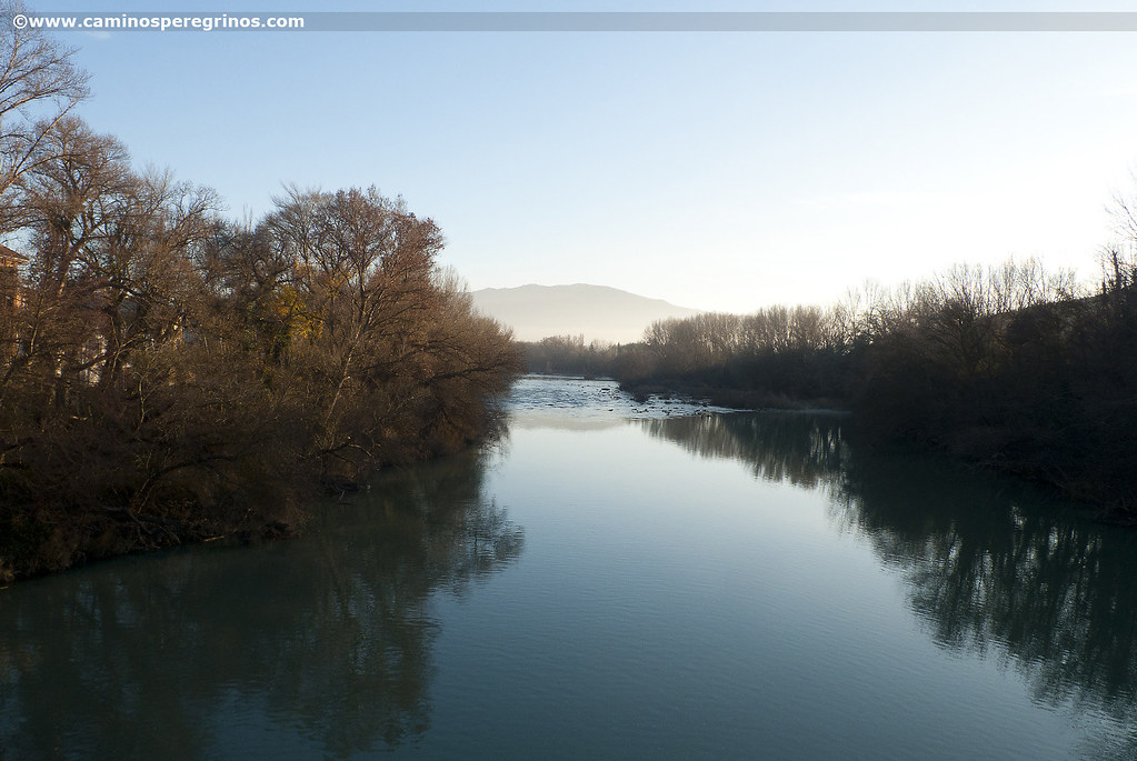
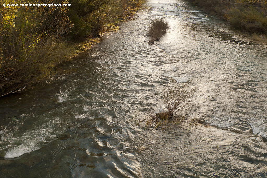
A Gorge by the Banks of the River Irati

Map from Sangüesa to Monreal via Foz de Lumbier. | CAMINOS PEREGRINOS

Elevation profile from Sangüesa to Monreal via Foz de Lumbier. | CAMINOS PEREGRINOS
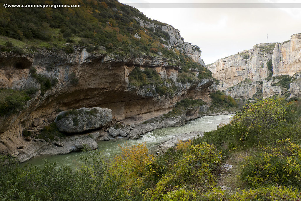
Besides the main route, there is a chance of walking along La Foz de Lumbier, a canyon carved by the River Irati that is home to a interesting population of birds that live on the rocks.
Alternative route via the Foz de Lumbier
From the pilgrims’ hostel, located at calle Enrique de Labrit, we pass next to the Gothic Church of San Salvador, built at the end of the 13th century, and link easily with calle Alfonso El Batallador. We move forward at the feet of the Vallesantoro Palace, which houses the cultural centre since 1970, and shortly after we reach the junction with calle Mayor, which we take on the left to arrive beside the church of Santa María la Real. Its facade, illustrated on the pages of every fine art book, is a pictorial treatise of the medieval style. It’s worth a break certainly. We cross the metallic bridge over the River Aragón, saying goodbye to it, and take the NA-8603 to the right towards Pamplona. Shortly after we pass the petrol station and then we leave behind the NA-5401 to Rocaforte, continuing along NA-8603 to Liédena) (km. 1,2).
NA-8603 Road to Liédena and Pamplona
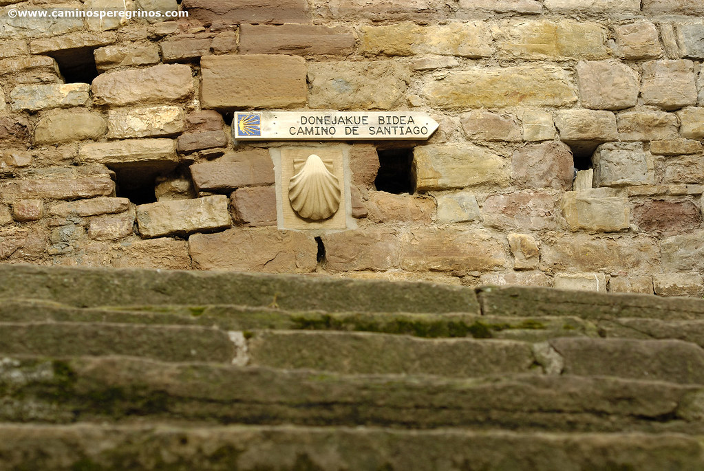
(32.1 km. left)We will leave the paper industry Smurfit Kappa on the left hand side until we reach a roundabout, where we will continue along the NA-127 towards Pamplona. On the right hand side we pass Rocaforte industrial park, going straight on the road after the roundabout. This first stretch is not very flattering because we will have to walk on the asphalt for several kilometers, following the course of the River Irati and paying attention to the traffic. Upon arriving at Hostal La Torre we cross the large parking and just after we take to the right the NA-2420, crossing the River Irati to enter in the village of Liédena. A few meters later we turn left (we will able to see some worn yellow arrows) pulling forward on calle Estación, that way we will take a gravel track marked as ‘Foz’.
600 meters later we finish in a track that runs parallel to the A-21 Highway. We will follow it to the left to pass under the A-21 a few hundred meters later (km. 6.4), and a little further on, paying attention to a green and white board that indicates ‘Foz’, we will turn left. That way we take another dirt track, reaching after more than a kilometer the entrance to La Foz (km. 8.5). A dark tunnel as black as coal gives access to the limestone canyon, overlapped frequently by griffon vultures and Egyptian vultures. A second tunnel will bring us out of this surprising habitat that offers a unique landscape. We will pass a leisure zone with grills and parking and we will take soon a sharp turn left. At 200 meters we turn right (km. 10.5) and we will follow the track for more than a kilometer. Thus we take the road to cross the River Salazar. A little further on we arrive at the access roundabout to the village of Lumbier. The Iru-Bide Hotel-Restaurant is a few meters to the right, where we can take a snack and refill the water bottle for the long stretch without any services that we still have to face.

A dark tunnel as black as coal gives access to the Foz de Lumbier. | CAMINOS PEREGRINOS
The Aragonese Way turns left, following its journey on the NA-150 in the direction of Pamplona. A paved track at the side of the road separates us a few hundred meters from the traffic. We cross the River Irati and take again the NA-150 for 200 meters, taking a stony track that appears on the right wayside. It runs about 150 meters from the road, on an area of loams and cultivated fields, including some vineyards (km. 12.5). After 1.7 kilometers we will turn 90º left, turning right hundred meters later. The new track will take us next to the A-21 Highway, which we avoid passing below it (km 15.5). Half a kilometer later we will take to the right another track that punishes us with a straight line of almost a kilometer. This leaves us at the gates of Nardués, which we must enter if we want to connect with the official route that comes from Rocaforte.
We go up on the local road until the NA-2420 Road. ¡Attention!, on the opposite wayside, beyond the traffic island, we will see some yellow arrows that encourage us to take a path (km. 17.5). We take it, without step aside and climbing a tough slope. Almost half a kilometer this path ends at a track that we follow on the left, linking in less than 200 meters with the official route.
Official route
(15.3 km. left)The Aragonese Way continues its mountainous progress across Izco mountain range, surrounded by Atlantic and Mediterranean landscape, going up gradually on a track that advances on the boundary of the forest and. At 1.7 kilometers we will find a gate that indicates Olaz, a place name that recalls the hamlet abandoned in the middle of the 15th century. We continue on the trail, sometimes accompanied by the buzzing of the wind farm, as regular as a washing machine. We will surpass a livestock building and a cattle grid one kilometer later, then we will reach the highest point of the stage.
Izco mountain range (cattle grid)
(11.3 km. left)We follow the track to the right and we let the waymarks guide us in the descent. The road to Izco, less than two kilometers away, opens up the doors to the Ibargoiti cereal valley of, which stretches westward between Izco, Tabar and Izaga mountain ranges and where the Higa de Monreal (1289 mt) stands out in the distance. After leaving the pine grove we take a long straight line of more than one kilometer that advances at the left of NA-2420 Road and A-21 Highway; this leads directly to the village of Izco, which we enter crossing a stream next to a cross. San Martín pilgrims’ hostel is located at the foot of the fronton.
Izco
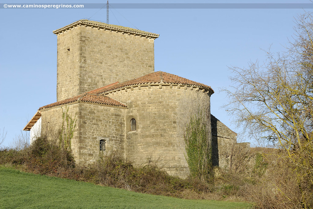
(9.4 km. left)Those who continue to Monreal should arm themselves with patience without looking too closely at La Higa de Monreal (1289 m), the lady of Alaiz mountain range. Without any hill that shades it around, its silhouette is distinguished from many points of Navarre geography. A couple of kilometers separate Izco from Abínzano where the church of San Pedro (13th century) greets at the entrance. Beside it we find a drinking fountain.
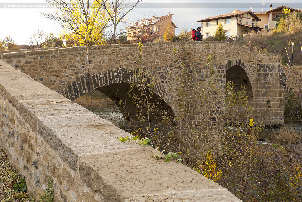
There is about an hour’s walk between Abínzano and Salinas de Ibargoiti. After the parish church we turn right and after few meters we turn left, facing another endless gravel track. On the right hand there are some agricultural buildings, while we set the course northwest towards the Higa de Monreal. Cereal fields, undulating, merge to the south with the mountain range and its wind farm, and we always move forward, ignoring the tracks that turn up here and there. Some rows of poplars sprout on the right side, beside a stream. The slope becomes much more favorable and the Aragonese Way crosses the barranco de los Sesur (ravine). The track ends at the road that links Zabalza with Salinas, which we will take to the right for only 100 meters, disconnecting from it by a track that advances over the road. It will take us to cross the beautiful medieval bridge over the River Elorz. At present we must go directly to Salinas de Ibargoiti, where there was a pilgrims’ hospital that was run by the Order of St. John of Jerusalem. This village had up to eight salt lakes, therefore its place name.

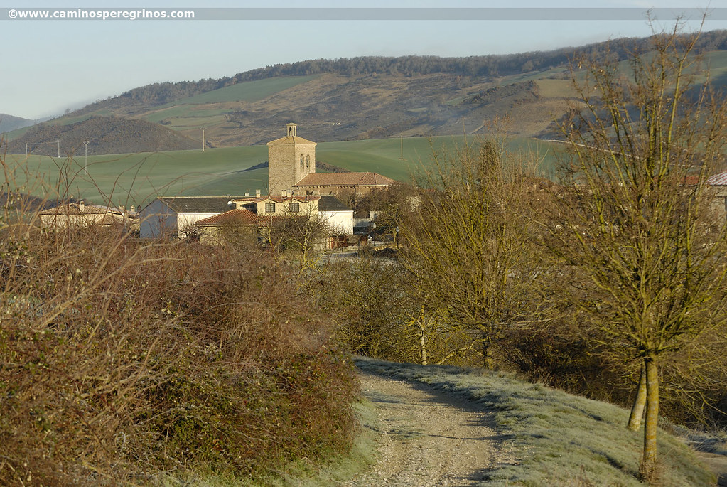
The silhouette of Higa de Monreal (Mount Monreal) is distinguished from many points of Navarre. | CAMINOS PEREGRINOS
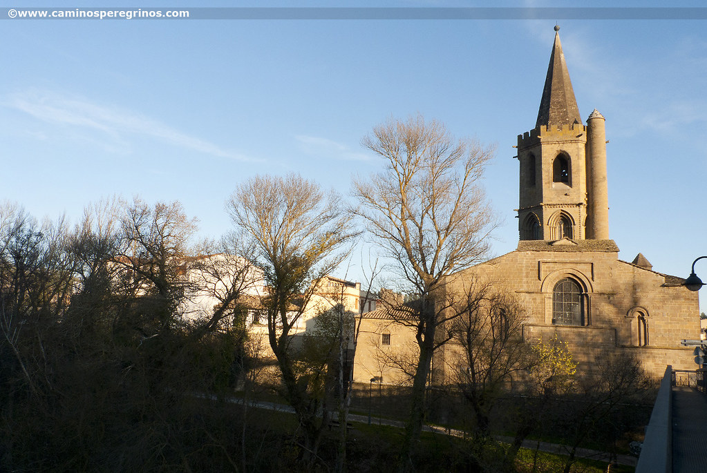
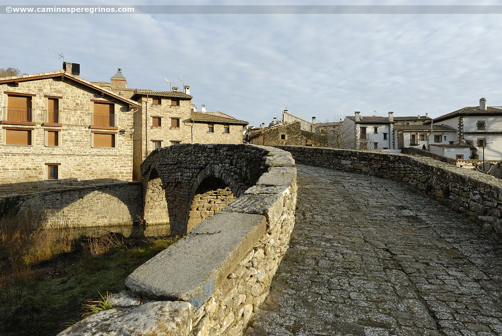
Before arriving at the church of San Miguel we turn left, crossing in few hundred meters the River Elorz. The last stretch until Monreal will leave a good impression on us since the riverbank woodland provides a shady shelter. At the entrance of the village of Monreal (Mons Reellus) quoted on the Codex Calixtinus as end of stage, we cross the river by a Gothic bridge with semicircular arch and another one pointed. Just after we continue straight along Santa Barbara Street and then we turn left on calle de la Corte. Stairs lead directly to the albergue de peregrinos, which has a skin, a clothesline and a small stone table in the back.
Monreal from a pilgrim`s eye view
One of the attractions of this Navarre quiet village, whose place name comes from Mons Regalis (Monte Real, in reference to the fact that these properties were one of the hunting scenes of the Navarrese kings) is the Gothic bridge over the River Elorz that we have crossed at the entrance of the village. It consists of a pair of arches, one of them is semicircular and the other one was designed in pointed style. If we stroll along the streets of Monreal, which was benefited from the privileges granted by García Ramírez in 1149 and besides it had the benefit of celebrating weekly markets, we will observe as part of the Jacobean itinerary (calles Santa Bárbara, El Burgo and Mayor) retains its medieval appearance. In addition there was a Jewish quarter where the calle Cuchillería is located. The hill of the old and disappeared castle rises over the church of La Natividad, emerging at the beginning like a simple defensive tower and ended up becoming in temporary residence of Navarrese monarchs. On calle El Burgo it is possible to take a path that leads to the ruins of the tower and towards an underground cistern that appeared in some excavations made in the sixties.