The Caminos Become Only One Route

Map from Monreal to Puente la Reina. | CAMINOS PEREGRINOS

Elevation profile from Monreal to Puente la Reina. | CAMINOS PEREGRINOS
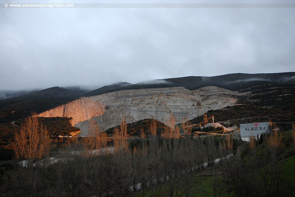
The Caminos coming from Somport and Roncesvalles become only one, not without first surpassing more than thirty kilometers. Beside the omnipresent Higa de Monreal, the road heritage is obvious along the riverside, with wayside crosses, bridges and old priories. This stage takes a walk around northern slope of Alaiz mountain range, wich is full of holm oaks and is pierced by the brilliant line of the Canal de Navarra.
Next to the rough quarries the itinerary advances toward Tiebas, whose albergue offers the possibility of dividing the stage, and progresses along Muruarte de Reta until the Valley of Izarbe. Olcoz opens its doors with its fortified tower and after a while the River Robo leads to Enériz and the Romanesque chapel of Santa María de Eunate, connected from its origin to the Jacobean Route. At the square of Obanos the pilgrims coming from the Aragonese Pyrenees and the Navarrese gather to descend to Puente la Reina, where both routes connect.
Route
We say bye for now to this village of around 500 residents among several houses with robust facades. At the end of Calle del Burgo there is a marker post that indicates 14 kilometers to Tiebas. Our route advances comfortably next to the silhouette of Higa de Monreal, also called Elomendi, whose summit reaches 1295 meters. The dirt track goes between wild rose bushes and cereal crops and reaches the riverside. A sign post indicates the Gothic wayside cross of San Blas, separated from the Jacobean Route, as we cross the river thanks to a wooden footbridge (km. 1.9). Soon we ended up on a track, turning left and crossing the river again by a concrete walkway. We follow the trail through the places of Zirimotz and Garitoain, getting a little closer of the slope of Alaiz mountain range. Before reaching Yárnoz we will go down some steps until a bridge (km. 4), taking advantage of the shade offered by boxwoods and holm oaks.
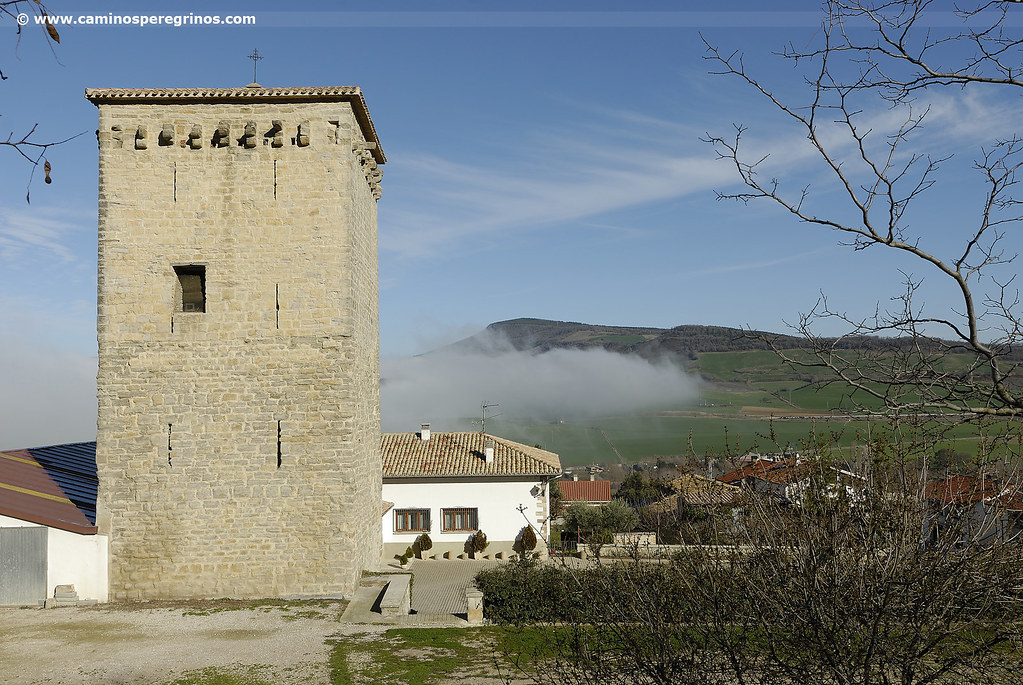
Yárnoz
(26.9 km. left)This tiny village stands out for its medieval tower built in the 14th and 15th centuries. A pavement track leads to the cemetery, where another dirt track that begins through a more rugged topography and also among a loam landscape, advancing parallel to the Canal de Navarra, which distributes the waters of the River Irati in the center and south of Navarra. The route seems to bifurcate before reaching the next village but it does not mind whatever track we take because both of them will lead us to Otano.

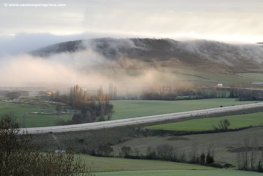
The first part of the stage advances parallel to the Canal de Navarra. | CAMINOS PEREGRINOS
Otano
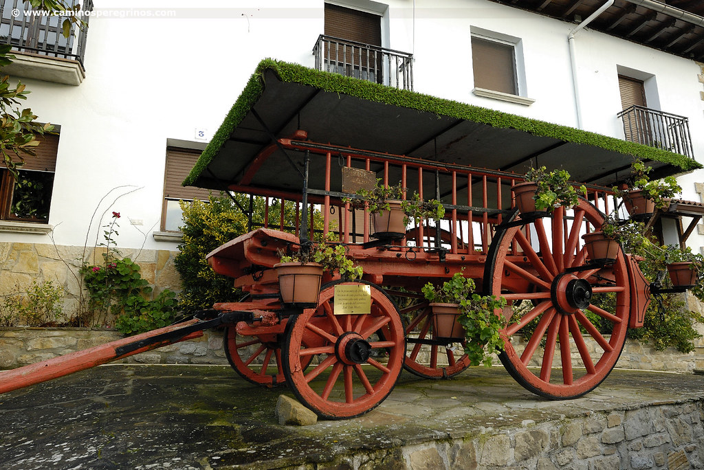
(25.2 km. left)Without losing sight of the Canal de Navarra, we will open a gate, closing it just after (km. 7.1) and half a kilometer later we will reach a paved track that we will take on the left. After 200 meters, in the vicinity of a quarry, we leave the track on the right side, viewing underneath the ancient manor of Ezperun. We return in this way to the pleasant but also tenacious route on the Alaiz hillside, taking a quick look at the Elorz Valley, with Noain and its aqueduct, Tajonar mountain range and the city of Pamplona. The path ends descending to the pleasant and well-kept village of Guerendiáin, with a drinking fountain at the entrance that invites to take a well-deserved rest. Just afterwards we pass by the wagon that was rebuilt in 2004 by the neighbors with the help of the cartwright José Luis Marín.
Guerendiáin
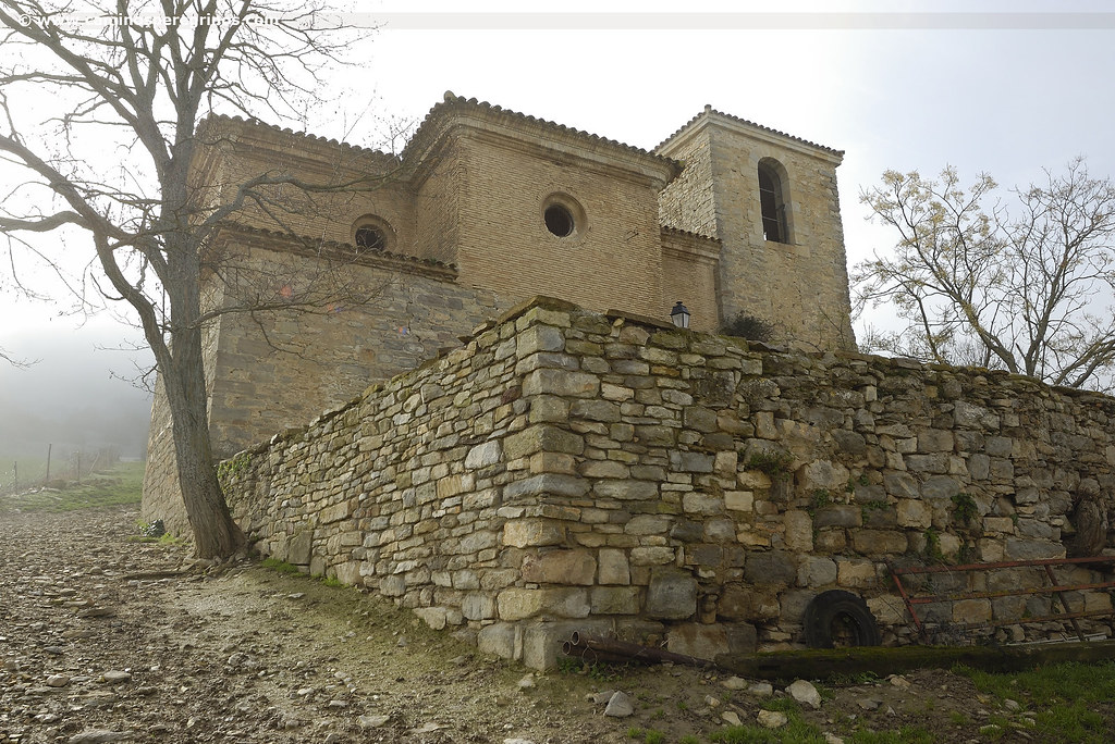
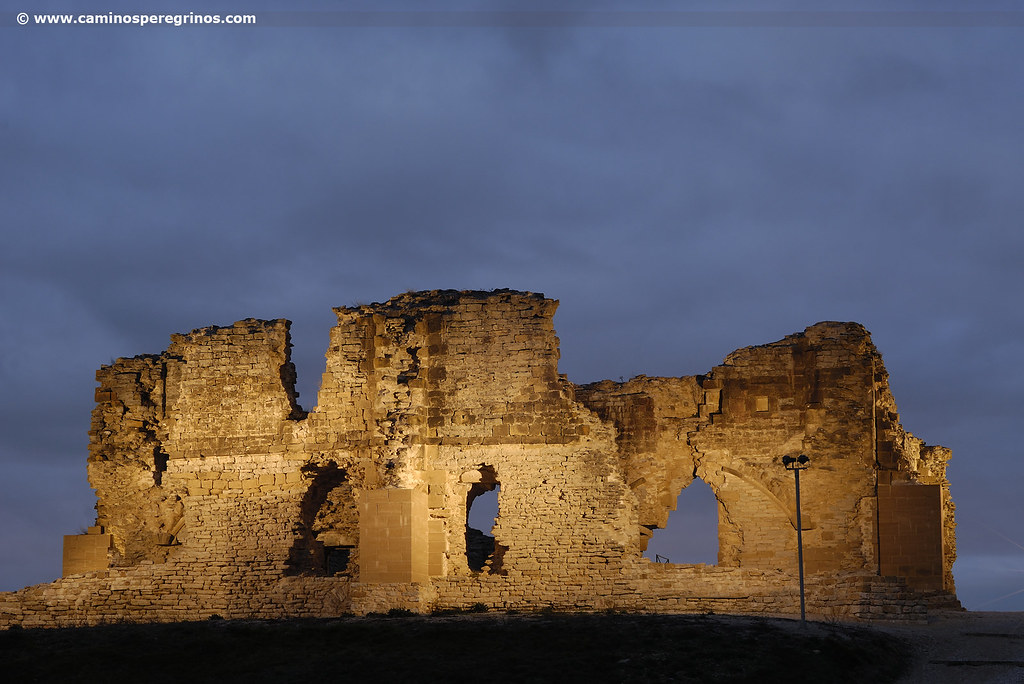
(21.7 km. left)At the exit of Guerendiáin we leave the medieval church of San Juan, restored with rather unsatisfactory mistake. From here the route sinks intermittently in the shade of kermes oaks and oaks for almost 3.5 kilometers, giving way to a gravel track (km. 12.3). We go down until a road and cross it to go up to a park to enter in the village of Tiebas. The ruins of the castle of Teobaldo I and his successor Theobald II lie at the entrance. It was destroyed in several battles and later rebuilt but it was godforsaken finally in the 17th century.

This castle in ruins is located at the entrance of Tiebas. |CAMINOS PEREGRINOS
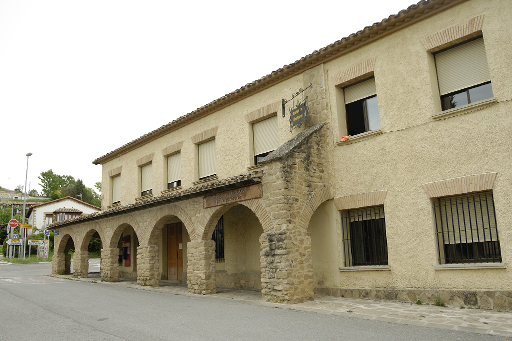
Tiebas
(17.9 km. left)We cross from end to end the main street, which brings us first to the pilgrim hostel and later next to Santa Eufemia church, a Gothic temple surrounded by a beautiful atrium of the 17th century. Right after we passed next to the bar and a private hostel and we continue passing a small square and leaving the school on the left, which work as the former pilgrim hostel that managed for so many years José María Flamarique. We continue ahead to cross the road that leads to Canteras Alaiz and go straight om beside the football pitch of C.D Castillo de Tiebas.
A landmark sign announces 3.8 km. to Muruarte de Reta. The road progresses along a plain at the edge of the crops, parallel to the AP-15 Highway. We find a fountain without sanitary guarantee before the dirt track ends up at a roundabout (km. 16.3). We pass it, crossing beneath the highway and then we take a path among pines and holm oaks that guides us along the perimeter of El Carrascal, an old military camp where only remains a few abandoned barracks. After the pedestrian subway under the railroad we reach Muruarte de Reta, finding a park with some benches with a fountain without health guarantees, another good place to take a rest.
Muruarte de Reta
(13.7 km. left)The section between Muruarte and Olcoz can be summarized in a modest local road and a kilometric straight line.
The Aragonese Way passes next to a place where the neighbours have enabled some vending machines, which is also perfect to take a break. Out of the route, at the other end of the village, it is the church of San Miguel, with a façade that is almost identical to that of Ermita de Eunate (chapel). Closer and visible from the route it is the tower-palace. It was rehabilitated between 2010 and 2011 and hosts an interpretation center about the Camino de Santiago. At the exit of the village we take a road from where we can see the valley of Ilzarbe, with the Canal de Navarra and the villages of Tirapu and Añorbe, the latter crowned by the summit of Mount San Martín and its homonym chapel. The route descends along an area populated with hawthorn and topped by a geodesic vertex (km. 19.8).
This section ends up on a path and passes by a plot with olive trees and other fruit trees. It is followed by a gravel track where we must pay special attention to a sharp turn right before reaching the local road, taking a path among poplars. Just after we cross the road that comes from Úcar and continue straight ahead on a track (km. 21.4). At the entrance a signal points 5.2 km. to Eunate and 10.1 km. to Puente la Reina. Cheer up! The track pushes us for almost two kilometers until the entrance of Enériz, which we enter by Cofradía Street.
Enériz
(7.9 km. left)Some yellow arrows lead to Plaza Consistorial, at the foot of the town hall of this village of just over 300 inhabitants bathed by the River Robo. On the same facade there is a grocery. A lot of attention! Afterwards the Camino does not continue towards Santa María Magdalena Church, but it turns left after the town hall and follows to the right along San Juan Street, where there is a monument dedicated to the Camino. This street later mutates in another gravel track that advances next to asparagus crops, which are collected at the beginning of the spring. We continue straight ahead for almost two kilometers and then we have to pay attention to a Camino de Santiago milestone located on the right side that encourages us to turn right to find a vegetable tunnel that leaves us beside the Ermita de Eunate (hermitage).

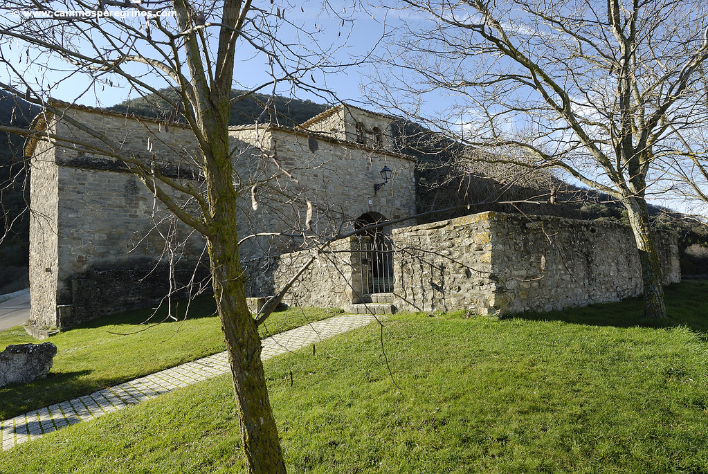
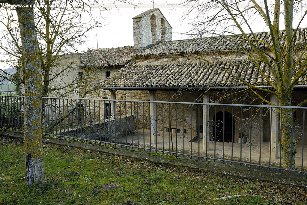
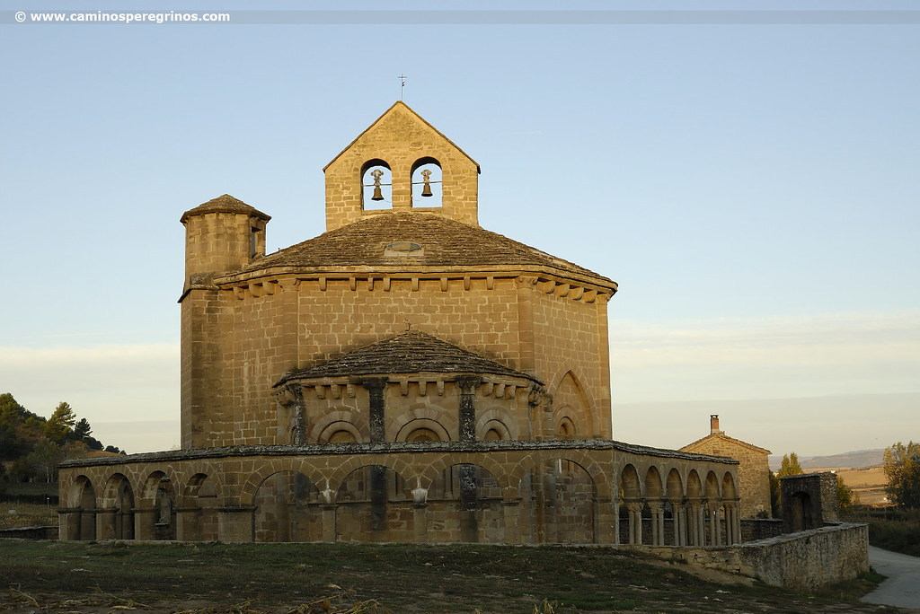
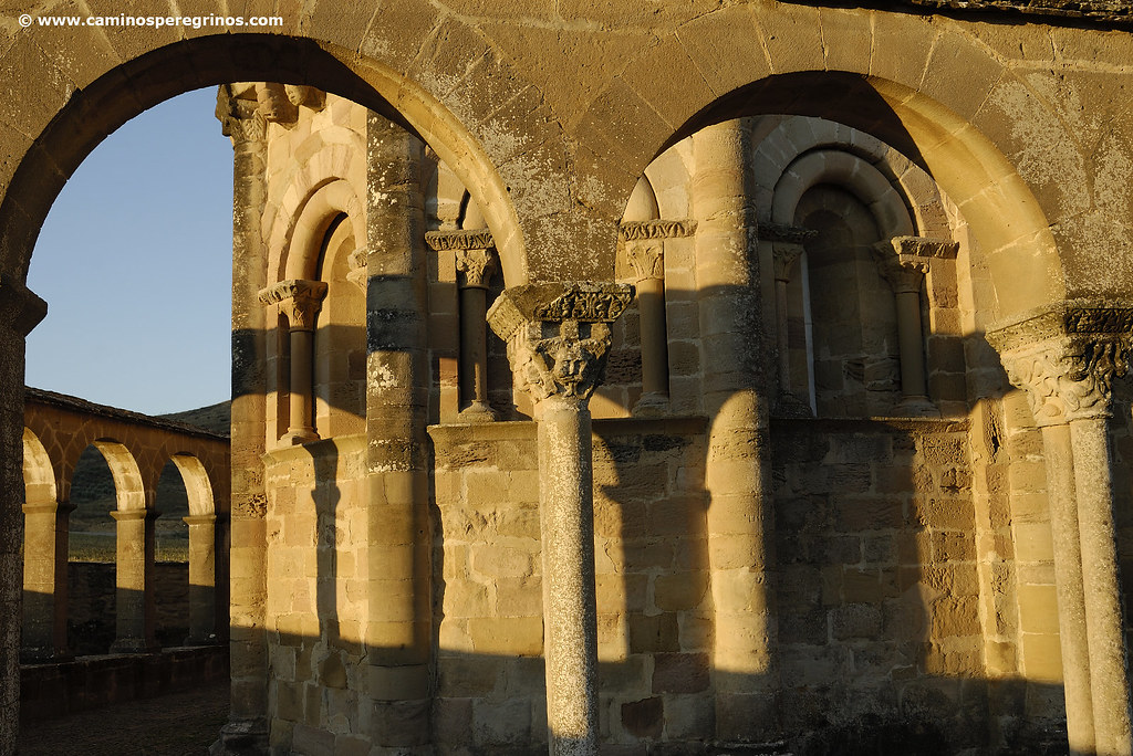
The unique Hermitage of Eunate stands out by the outside archwork arranged on its octagonal floor. | CAMINOS PEREGRINOS
Ermita de Eunate
(5.1 km. left)This unique shrine stands out by the outside archwork arranged on its octagonal floor. The capitals show rich details where masks, plant motifs, human figures and beasts come together. On the origin and construction of the temple are shuffled several hypotheses, from templar construction to pilgrims’ hospital run by the Order of Saint John of Jerusalem; also chapel and cemetery of pilgrims. After Eunate we leave a rest area on the left and we take a track that 700 meters later leaves us on the NA-6064 Road. We cross it and continue along the paved track that appears in front of us (km. 27.3). In a little more than a kilometer we reach Obanos, which we enter after crossing the NA-6062 and overcome an uphill. From both calles San Sebastián and San Guillermo, we converge on Plaza Los Fueros, where the Ayuntamiento (Town Hall) and the church of San Juan Bautista also meet.
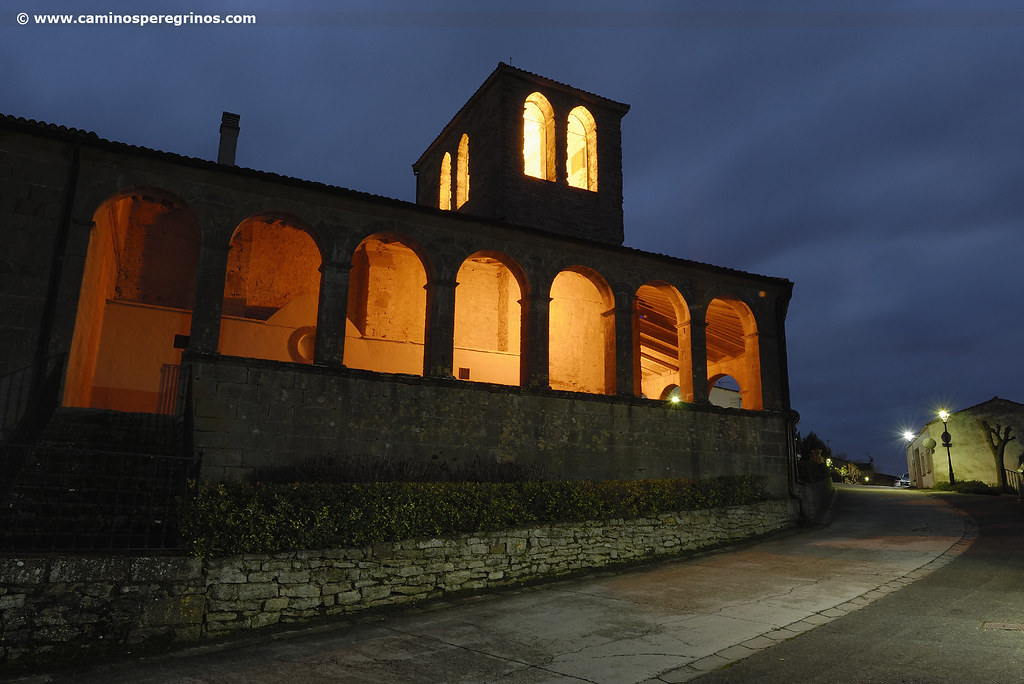
We join at this square with the pilgrims who left from Roncesvalles, Saint Jean Pied de Port or even further. The guidebook by Don Elías Valiña placed the meeting a few meters ahead, at San Salvador Chapel, where we go descend until the road. We cross it and take a walk next to the vegetable gardens of the River Robo that leaves us on the final section. We passed by the hotel and albergue Jakue and a few hundred meters later we arrive at albergue de peregrinos of Padres Reparadores. Under the arch of the church of Crucifijo we take the street of the same name, which connects with Calle Mayor, where the Caminos become only one.
Puente la Reina from a pilgrim`s eye view
If we set off from the albergue de peregrinos we can head for the immediate church of Crucifijo. It is joined by a photogenic arch to the school and seminary that flies over the Camino de Santiago and simultaneously covers the facade of this Templar church. It was founded around the middle of the 12th century and two centuries later it was enlarged with the construction of another nave. If we do not turn on the lights, wandering under the residual light, we will find the perfect atmosphere to admire the mysterious Gothic carving of Christ Crucified with the cross in the shape of ‘Y’, in the form of a goose paw as well, intensifying the enigmatic nexus between the Camino de Santiago and this waterfowl. Apparently, this carving was given by German pilgrims returning from Santiago.
Continuing along calle del Crucifijo we cross the road and follow ahead to access to the calle Mayor, where before arriving at the church of Santiago we can notice several palatial houses. Perpendicularly to Mayor Street there are some belenas, alleys that gave access and service to stores, workshops and warehouses. Later we cross the grille that delimits the church of Santiago, whose facade presents a curious arco lobulado (a curious kind of arch) of the style that we can find later in the church of San Román of Cirauqui and in San Pedro de la Rúa of Estella. The interior of the temple hides the well-known Santiago Beltza, a 14th century sculpture of the Apostle. It has a dark complexion as its name in Basque language indicates. Finally, a short stretch brings us closer to one of the icons of the Camino Francés, the Romanesque bridge crossing the River Arga. With its more than 100 meters length, it was built in the 11th century on the initiative of Doña Mayor de Castilla or Doña Estefanía. A legend relates that a small bird or txori collected water from the river with its beak and carefully washed and groomed the image of the Virgin that was housed in one of the dissapeared defensive towers of this iconic bridge.
Gastronomy and food in Puente la Reina
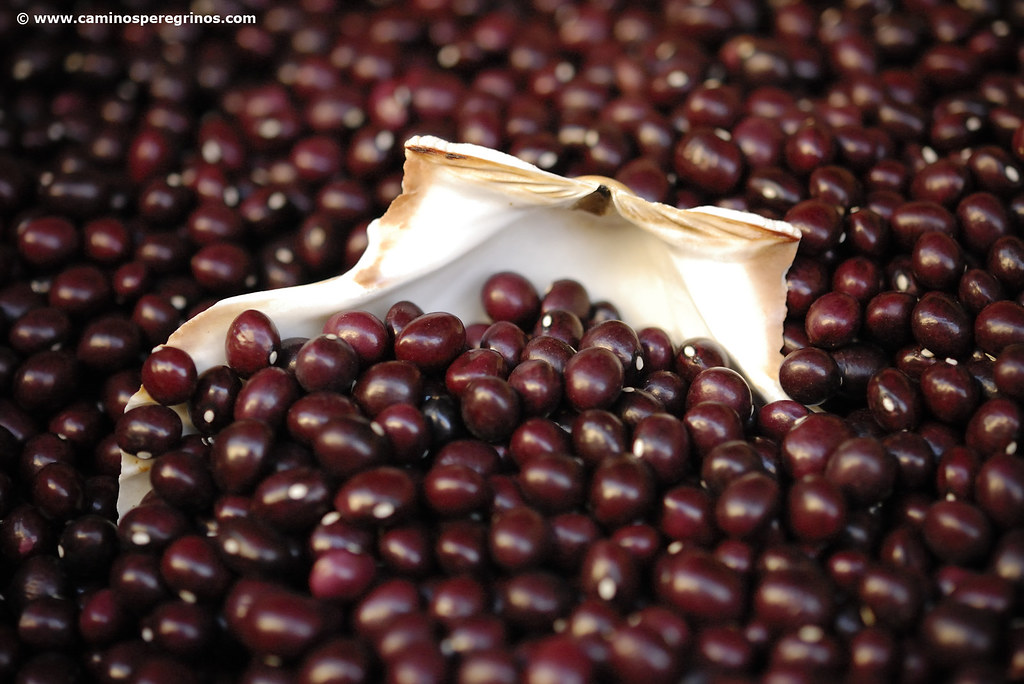
Any hospitalero can recommend us several restaurants where we can find typical local dishes. We will have the opportunity to try starters such as chorizos with cider, chistorra, Tudela head lettuces, asparagus or roasted peppers. Among the first dishes there are recipes made with vegetables and legumes, such as the red beans of Puente la Reina. If our pilgrimage coincides between September and December, perhaps we will have the opportunity to approach the market that is installed in Campa de la Fundación Mena, which releases an indescribable aroma of roasted peppers and other local agricultural products.