Captivated by the Sublime Pyrenean Landscape

Map from Somport to Jaca. | CAMINOS PEREGRINOS

Elevation profile from Somport to Jaca. | CAMINOS PEREGRINOS
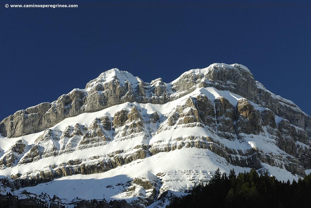
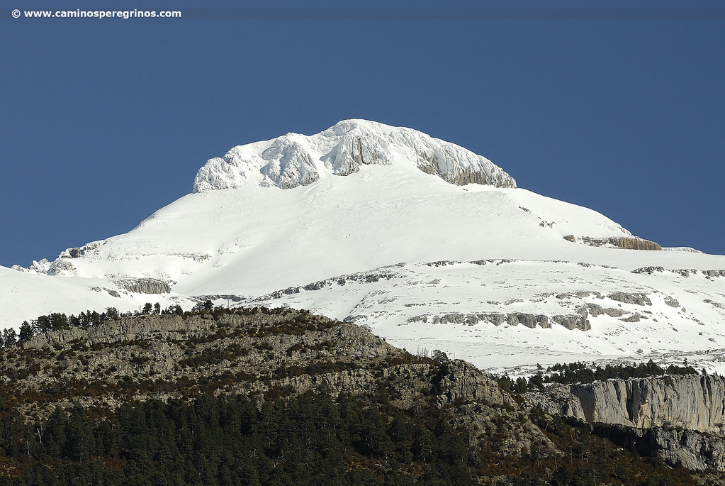
The Vía Tolosana coming from Provence crosses Béarn, a French province located in the Pyrenees, until reaching the top of Somport. From this mountain pass, this route is better known as the French Way through Aragón or Aragonese Way. Thus, at an altitude of 1632 meters, under the magnificent Mount Aspe, the path follows the course of the River Aragón whose waters lead to the ruins of the famous pilgrims’ hospital of Santa Cristina.
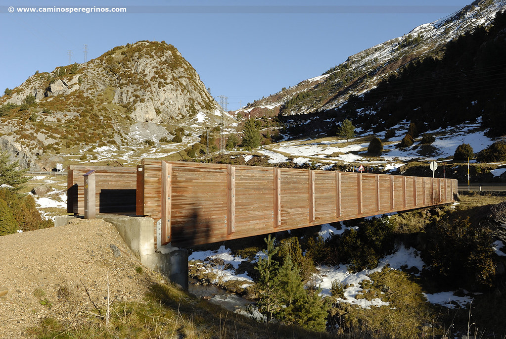
Protected by sublime summits, among woods and refreshing waterfalls, together with all kinds of bunkers and military fortifications destined in its day to protect the border, the narrow valley opens to Canfranc Estación, and then follows the little village of Canfranc. Our journey continues over the beautiful Pon Nou, a bridge which channels the route to Villanúa, a village located at the feet of Collarada, the highest mountain of the region of La Jacetania.
Two possible routes emerge at the entrance of Villanúa, the first one advances by the left bank of the River Aragón and the other, the historical one, to the other side of the N-330 next to the manor of Aruej. Both meet at the picturesque Castiello de Jaca, a gateway to the Garcipollera valley, also known as ‘the village of the hundred relics.’ From its antique historicalheart, dominated by the Romanesque church of San Miguel, the route descends to the rocky banks of the rivers Ijuez and Aragón, passing next to the mill of Bergosa and several bridges, like the one of Torrijos and Grallas. Finally, facing the unmistakable silhouette of Peña Oroel, the chapel of San Cristobal leads to the gates of Jaca, capital of the region of La Jacetania which provides numerous tourist attractions.
Route
Somport
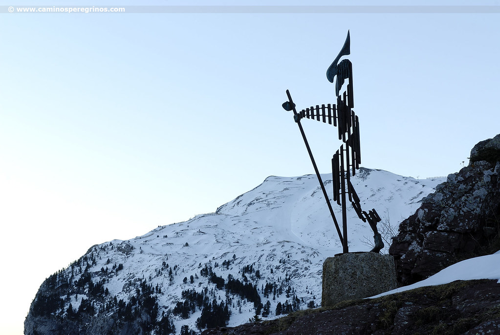
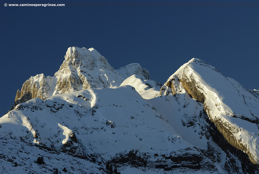
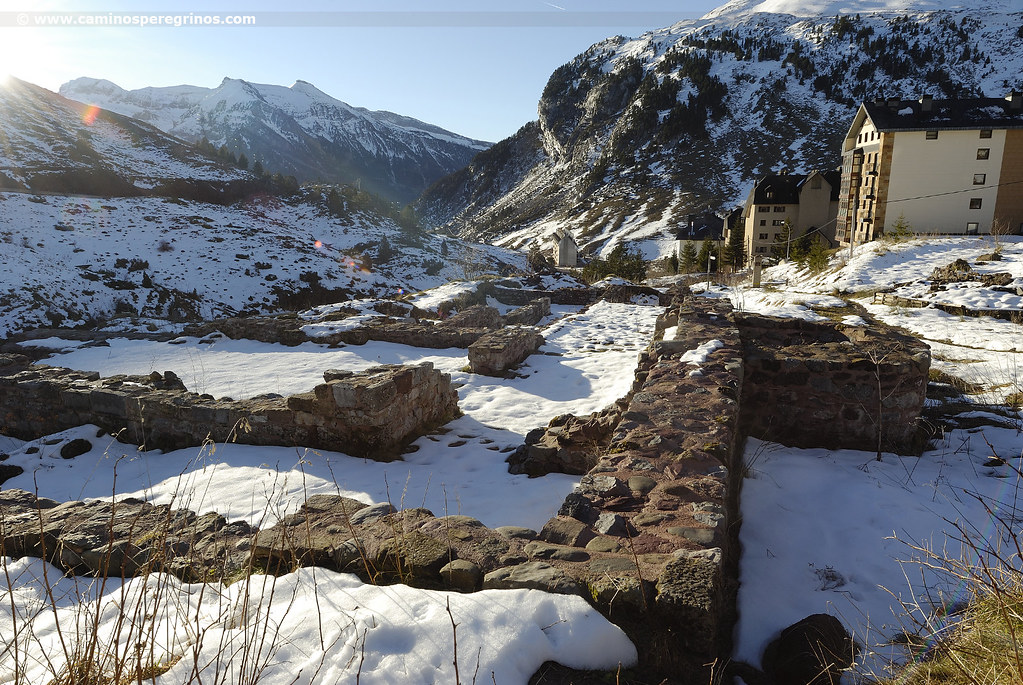
(30.5 km. left)At an altitude of more than 1600 meters, the Vía Tolosana, which crosses the end of Provence and the Languedoc, goes across the Pyrenees by the Beárne and surpasses the Somport mountain pass. We set off at the foot of the road, a few meters far from the futuristic silhouette of a pilgrim that arises from the top of a rose-colored rock, descending the stairs located next to the milestone indicating the distances: no less than 858 km. to Compostela. Glancing down over the bottom of the valley, we discover the silhouette of Mount Collarada, which, with its 2886 meters, represents the maximum height of La Jacetania Aragonese region. Meanwhile, a path goes down beside the River Aragón, which emerges from the torrents of the Pyrenean lakes of Astún. In less than a kilometer we run into the ruins of the hospital of Santa Cristina, “one of the columns that God established in this world for the support of the poor people”, as it appears on the Codex Calixtinus, the famous pilgrim guidebook written in the 12th century (km. 0.8).
More steps reinforced by a wooden railing jump onto the road leading to Candanchú Ski Resort; instead, we cross the Santa Cristina bridge over the River Aragón and continue to the left, immediately climbing another flight of stairs until the N-330. We cross this road and walk forward, advancing on pastureland and alpine woodland. The difference in altitude that separates us from Jaca will give us the opportunity to witness a large variety of vegetation, from beeches and fir plantation to Gall oaks. The Way is soon divided into two possible itineraries:
- Following the steel milestones, we have the opportunity to approach the N-330 and cross the River Aragón over the Puente del Ruso, and continue the march to Canfranc Station by the right bank of the Aragón.
- We will describe, however, the one that advances along the left bank of the river, only a few hundred meters longer. Without jumping to the road, we made the descent from yellow arrow to yellow arrow, between rocks and alpine woodland, where there are some bunkers of the well-known ‘Línea P’, which were built between 1944 and 1959 to protect a feasible invasion from France. On the other side of the N-330, on the right hand side, we discern the military camp of Rioseta, under the cirque of the same name and the prominent Eagle Peak (1972 m). Following the river’s course, the route turns to the east during a certain section, reaching between pine trees the ruins of the Fundería del Anglasé (an iron and copper foundry). In the middle of the s. XIX there were also a factory and a hostelry, constituting for sure a place to stop on the Camino Real between France and Spain.
Fundería del Anglasé
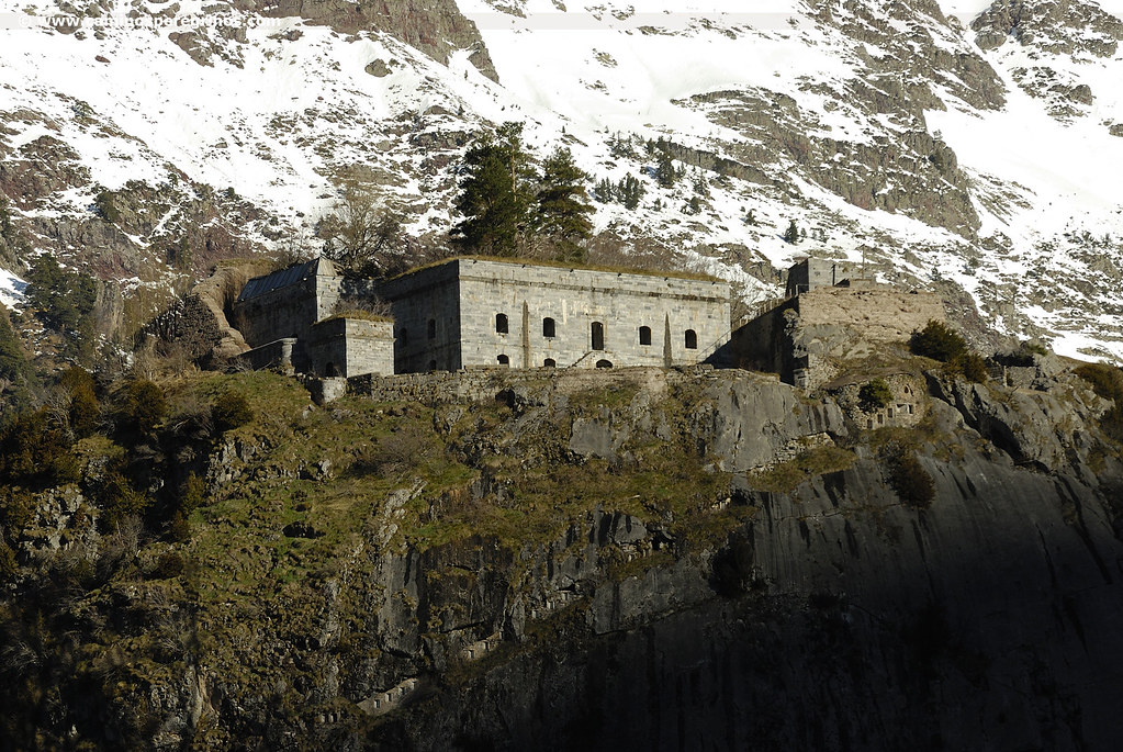
(27.4 km. left)Called by the loud noise of the water, we cross in half a kilometer the river of the Canal Roya that descends from the tarns of Mount Anayet, introducing us 20 minutes later over the barranco de Izas (ravine) (km. 4.9), which we cross by a wooden footbridge. We eagerly continue, surrounding the rocks where the Coll de Ladrones is located. In its top there is a fort designed in 1888 for the defense of the Canfranc valley; Behind it stands the top of Mount La Raca (2278 m). More than a kilometer separates us from the following landmark: the bridge of Roldán, where we cross to the other side of the River Aragón to access the old village of Arañones, which expanded in 1880 due to the construction of the International Railway Station, which later would become the Canfranc-Station, where all the facilities and the city council are located. We can avoid the N-330 thanks to an enabled path by the left shoulder, where there is a parking. The International Railway Station stands above as a stranded transatlantic; its construction started in 1928 and continued until 1970, when the railway connection with France was closed. However, even today, the Canfranero, a train coming from Zaragoza, is still working. As we approach the modern church of Nuestra Señora del Pilar, with a fan-shaped design, there are plenty of opportunities to take a break.

The International Railway Station of Canfranc. | CAMINOS PEREGRINOS
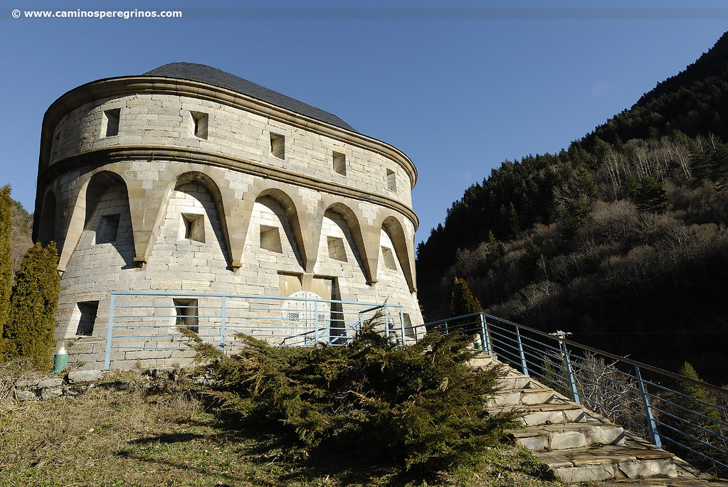
We leave the town hall behind and we get away from the road for a few meters and follow the river, returning later to the paved shoulder of the N-330 to continue through this small town. At the exit, next to the Secrás bridge and the hydro-electric plant, we choose the red pedestrian path, leaving on the right the lanes that lead to the tunnel of Somport. Later we pass by tunnel of Ip, barely 80 meters length. On the way out, we take the stairs leading down to the ruins of the tower of La Espelunca, built at the end of the 16th century. Under the dyke of the reservoir, we cross once more the River Aragón, soon appreciating the tower of Fusileros on the other side of the road. This fortification was designed in 1877 to defend the road between Zaragoza and France. Its ellipse floor would house a garrison of 25 soldiers, an infirmary, a dungeon, a woodshed and a few quarters. We continue between enclosing walls, guided by a good stretch of the old road of the Porciocas, already in use in the 16th century. A kilometer and a half later we cross the River Aragón and witness a dense tree-lined riverbank. We cross the barranco de Ip, which collapses on the left in an elegant waterfall (km. 10).
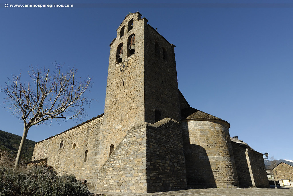
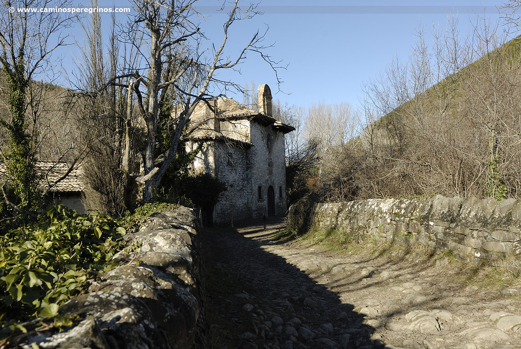
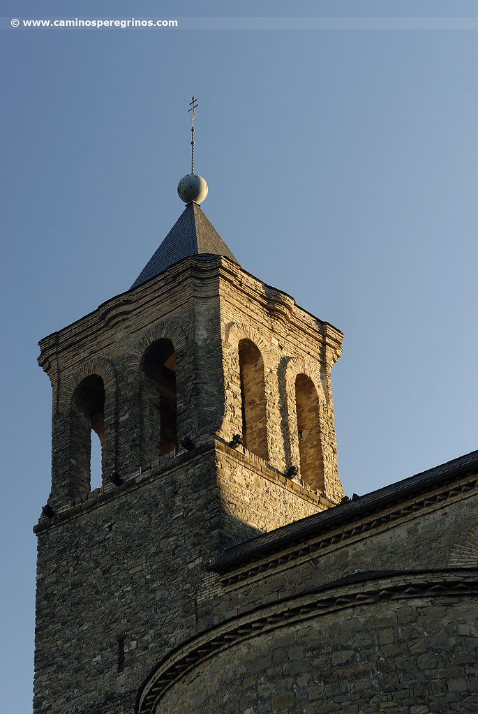
After 800 meters, after crossing the barranco de Cherimosa, whose waters nourish the Aragón from the eastern slope, we cross the riverbed by another bridge. Next to the 847 km. to Santiago milestone, we momentarily lead to the N-330 to go into Canfranc. This road town, in symbiosis with the way itself and where there was a private shelter, emerged in the 11th century and its inhabitants used to demand taxes for the passage of merchandise. Canfranc was almost completely devastated by a catastrophic fire in 1944 and the town hall and services, as we have seen, were moved to Canfranc-Estación. The Way of Saint James crosses the village from north to south, visiting the parish church of Nuestra Señora de la Asunción, which replaced in the 16th century the temple that was raised four centuries earlier. It consists of three naves and an octagonal bell tower.
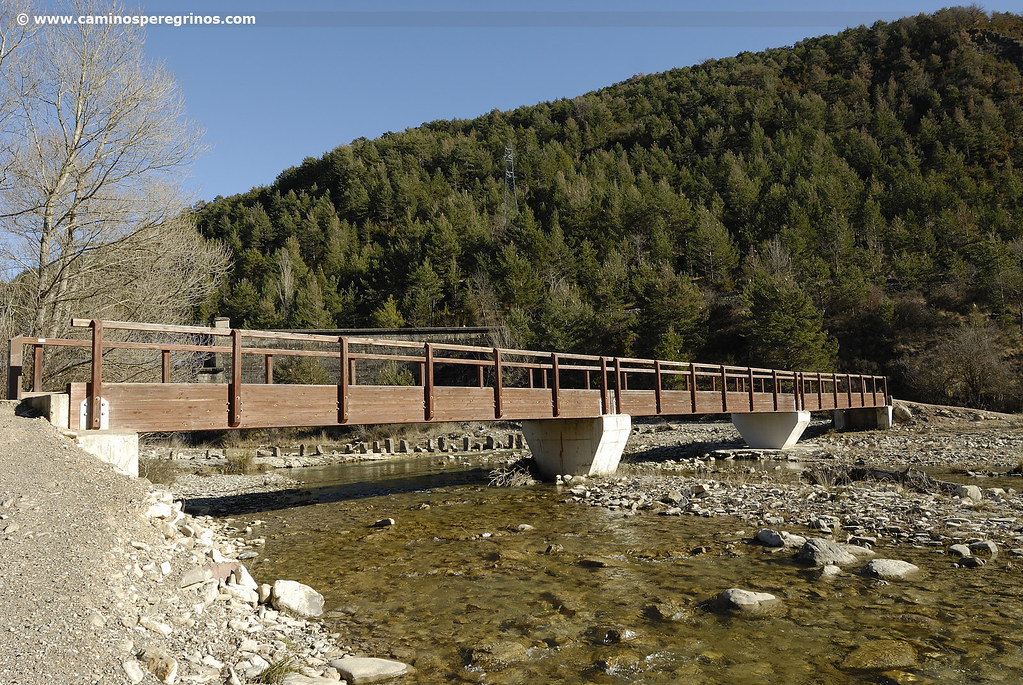
At the exit we take the road that leads us to the ruins of the church of La Trinidad; it was founded in the 16th century and abandoned three centuries later. A little further, the road once again crosses the River Aragón thanks to the photogenic bridge of Abajo, previously known as Pon Nou, which was rebuilt in 1599 by the expert stonecutter Ramón de Argelas. The next section along the left bank of the River Aragón will take us to the bridge of Villanúa, almost four kilometers away from the Pon Nou. The author José Luis Ona, in his guidebook Guía del Camino Jacobeo en Aragón, reveals the history, itinerary, characteristics, antiquity and techniques of construction of the road in each of its sections; consulting this guide is worthy, for it allows you to delve into this Jacobean route as well as the ins and outs of road engineering. A bit more than a kilometer far from the Pon Nou, we cross by a footbridge the barranco de Los Azús (km. 13).
Right after we pass between rocky grounds by the bunker and shelter of Peña Caída; after this we cross the N-330 thanks to a tunnel. We continue this stage choreographing each of the curves that the River Aragón traces, whose bed flows 30 meters below. The presence of meadows and a more humanized landscape will gain ground later, announcing the proximity of Villanúa. It is preceded by a dolmen and the cave of the Güixas, which has been visited since 1929. Soon we arrive at the car park next to Subterránea, as it is called the interpretation centre of the caves, and the bridge over the River Aragón.
At the entrance of the medieval bridge of Villanúa, distorted by the metallic railing and paved eyesore, stands a pole that indicates another pair of options to continue the stage:
- GR 65.3.1 continues to Castiello between the left bank of the river and the railroad tracks. It first visits the center of Villanúa and leave the village being guided by the yellow arrows and the red and white marks of the GR. It is a peaceful route, away from the road, and crosses the creeks that flows into the River Aragón. Crossing the river and the N-330 next to the residential area ‘Residencial Mirador’, we access soon to the highest part of Castiello de Jaca, where we pass by the church of San Miguel. The length of this section is similar to that of the other alternative, which we will narrate in more detail.
- On the GR 65.3, the historical route, we descend some stairs after the bridge. Next meters to the N-330 we descend more steps that lead us to cross the barranco Gorgazos. Separated from the road by an urbanization (at the feet of the road there are several cafes and restaurants), we cross shortly after the channel of the barranco de Regulierde and we move forward until the exit of Villanúa, where we continue on a cabañera (as the cattle routes are denominated in Aragón). If we look back we see from another angle the top of Mount Collarada, which we have contemplated from Somport this early morning. The cabañera advances parallel to a rest area and then follows the course of the N-330, hoping to have the shadow of the black poplars that accompany the cattle route. After more than a kilometer of the rest area, we cross the barranco de San Chaime (km. 18.1) by a footbridge and half a kilometer later we cross the road beside a pine grove.
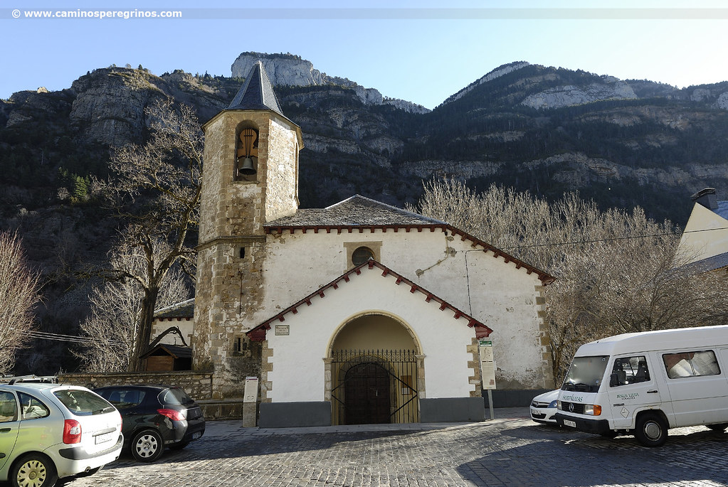
The Way of Saint James passes next to the Gabardip colony, a former pinecone drying house which was rehabilitated to be home to summer camps. We continue under the village of Aratorés until we reach the road leading to Borau and Aisa. Discarding the road next to the canal, we go down the road 300 meters and when we reach Villa Juanita, we turn right to take the cabañera again. A comfortable terrain, with the presence of a pond and several barrancos (ravines), such as Beldorero and Gabardito (km. 21.7), leads to Castiello de Jaca. Just before the village we pass close to the Albergue ANoguera, which is located on the right. Castiello de Jaca is well-known as ‘de las cien reliquias’ (of the hundred relics), since a Valencian pilgrim donated some relics in appreciation for the help received by the residents of this village. The church of San Miguel Arcángel consists of a fortified tower, whose primitive construction goes back to 12th century. We can approach it to visit it or to descend directly by the calle Santiago (Santiago Street) until the N-330, admiring the chimneys on the roofs of slab and slate.

Traditional chimneys on the roofs of Castiello de Jaca. | CAMINOS PEREGRINOS
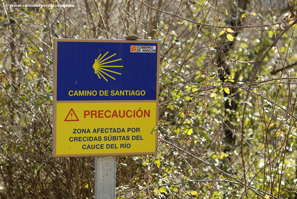
We meet on the N-330, where several restaurants are located; then we cross the pedestrian crossing and we head straight for La Garcipollera. After crossing the square we cross the River Aragón and turn to the right, taking a path that can be inundated by the sudden floods of the riverbed, so better safe than sorry. We arrive in 700 meters at the bank of the River Ijuez, where we see a rudimentary stone footbridge that by its own merits was one of the most conflictive points of the Aragonese Way, when the increase of the flow caused real danger when crossing. A safe footbridge was built in 2010, a few meters down, which ended the problem and serves us to reach the opposite shore (km. 24.1). We meet the River Aragón 200 meters later on and we advance between the railroad tracks and the river, reaching the flour mill of Bergosa in approximately one kilometer. 800 meters later, through a vegetable garden area, we reach the Torrijos bridge, built in 1876 (km. 26).
Without having to cross it, we descend to the river by stairs, passing under the N-330. We face the last hour of this stage. Just follow the path beside the N-330, next to the hotel-restaurant and riding center Charlé and passing by close to the bridge of the Grallas 800 meters later (km 27.7). We continue beside the N-330 for 600 meters and then we go to meet the chapel of San Cristóbal, built in 1796 by a dyer from Jaca.
Chapel of San Cristóbal
(1.9 km. left)Just after crossing the barranco del Rapitán, by its namesake medieval bridge. Further on we arrive at the beginning of a steep slope. A flight of steps finally lead us to a park, where there was a significant tree known as Árbol de la Salud (Tree of Health). It was an elm planted in the XVIII and died by Dutch elm disease in 1997. It was replaced by a horse chestnut, but this one was cut down by a heartless in 2012, and finally it was replaced by another chestnut that same year. A board expands this information. We leave on the right, taking paseo de la Cantera, continuing straight on avenida de Francia for 700 meters. At the height of the citadel, we go over the pedestrian crossing and the tree-lined traffic island to approach plaza de San Pedro and the cathedral. We cross the plaza de la Catedral and we continue with no loss by calle de Bellido, linking with calle de la Puerta Nueva. Then we turn to the right in the first side-street, taking the narrow calle del Hospital, and then we continue to the right, taking travesía Conde Aznar and arriving immediately after at albergue de peregrinos (pilgrims’ hostel).
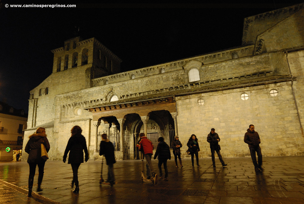
Jaca from a pilgrim’s eye view
Jaca Tourist Office: Plaza de San Pedro nº 11-13 (near the cathedral) 974 360 098 oficinaturismo@aytojaca.es
After this Pyrenean day, the plaza de la Catedral is a good place to start a short visit to Jaca. The Romanesque Cathedral of San Pedro was built in Romanesque style during the year 1075 at the initiative of Sancho Ramírez. This was the time when Jaca became an ecclesiastic office, as well as the capital of the new-born Aragonese Kingdom. Some parts of the temple, such as archivolts and friezes, were decorated with the characteristic checkered known as jaqués, named after this place because it was used for the first time in this cathedral before extending to more churches of the Way of Saint James. Inside of the cathedral, the Diocesan Museum deserves to be looked at because of its valuable samples of medieval mural painting.
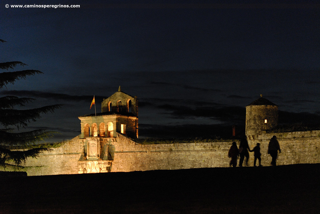
From Cathedrals main square we can take calle del Obispo up to the intersection with the commercial and crowded Calle Mayor. it is easy to find the plateresque town hall and several modernist buildings on the facades of numbers 17, 20 and 32. From the main artery we can go to avenida del Primer Viernes de Mayo and approach the Citadel, surrounded by a magnificent grass lawn. This citadel was designed in 1592 by the Italian engineer Tiburzio Spanocchi, who was in the service of Philip the II. The visit, both outside and inside (the latter for a fee), allows us to know the different elements of this fortification, such as bastions, casemates, etc. One of its barracks is home to a remarkable museum, which includes a collection of more than 32,000 figures of lead soldiers, a detailed display on the evolution of weapons, uniforms, combat tactics and armed warfare history since the time of pharaohs.
Gastronomy and food in Jaca
We will find countless tapas and menus in the bars and restaurants of Jaca where we will be able to taste home-made food from the Aragonese Pyrenees. From renowned cheeses, cold meats, boletus, migas de pastor, ternasco, veal steak and a variety of appetizing homemade pastries, such as torrijas (French toast), puff pastry, curd, flan, pooched pears in red wine, etc. In turn, the more gluttonous can visit the sweet shops and taste any of the traditional Aragonese sweets: Adoquines del Pilar, Frutas de Aragón, Coronitas de Santa Orosia, Besitos, Lazos de Jaca, etc